
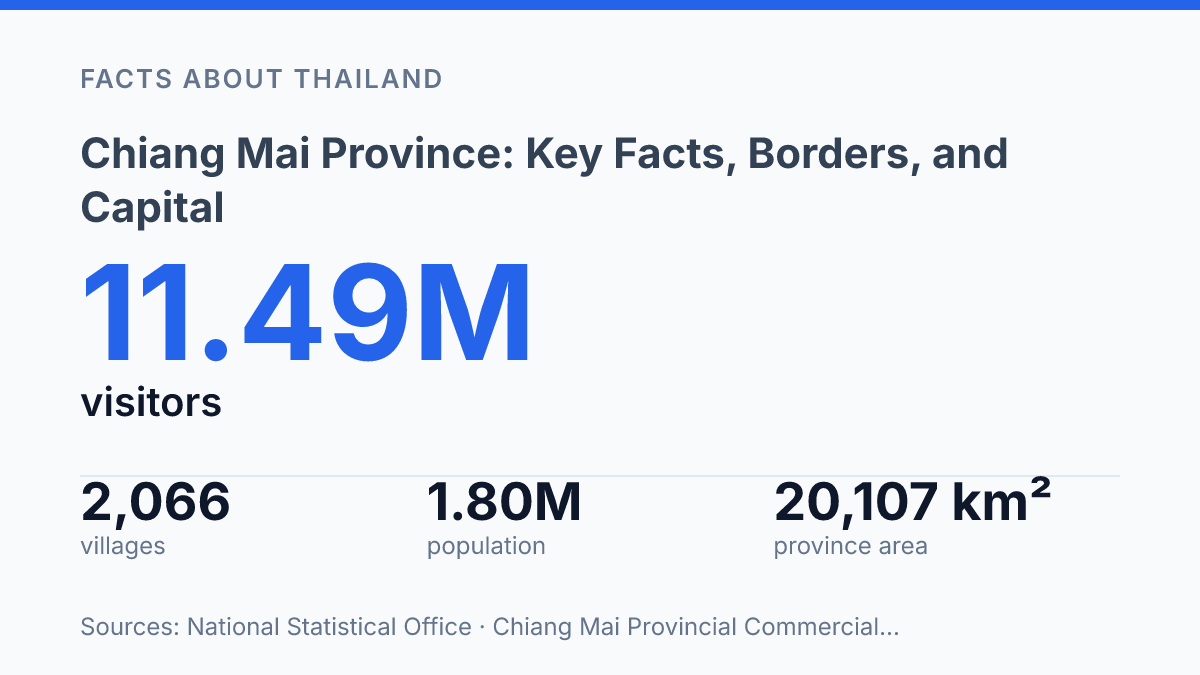
Chiang Mai province is not Thailand’s northern footnote: at 20,107.057 sq km, it is the North’s largest province and the country’s second-largest by area after Nakhon Ratchasima. That size matters. It changes how you read the map, the border, the economy, and even the role of the capital.
The province sits 696 km from Bangkok, but distance is only part of the story. Its 227 km border with Myanmar runs through five districts. This isn’t a neat inland destination with one simple identity.
It’s a mountain province, a border province. A major administrative unit at once.
Then there’s the city. Founded as the capital of Lanna in 1296 CE, Chiang Mai still carries more weight than a provincial capital usually does. In my honest opinion, the map only makes sense when you treat the capital as a power center, not a label.
Where Chiang Mai province sits in northern Thailand
Chiang Mai province sits far enough north of Bangkok for the distance to read like isolation, but its scale makes that impression misleading. It lies in upper northern Thailand, where it functions as one of the country’s main northern administrative anchors rather than a peripheral mountain province.
The province’s size is the first clue. A Chiang Mai Provincial Commercial Office, 2019 page / current province profile lists it at 20,107.057 sq km, ranking No. 1 in the North and No. 2 nationally after Nakhon Ratchasima, with Bangkok listed 696 km away. That also explains why the common shorthand of calling it the largest province, or changwat, by area needs care: its dominance is clearest within northern Thailand.
Population adds the second clue. The province has about 1.78 million people. It isn’t just large on a map.
Size without population can mean administrative spread. Here, the two combine into real regional weight.
The capital, Chiang Mai, gives that weight a clear center. It sits 685 kilometres (426 mi) north of Bangkok, close enough to remain tied into the national frame yet far enough to shape its own northern role. In my view, that distance is the most useful way to understand the province: not remote, but distinct.
By 2019 official provincial framing, the location, area, and administrative position all point in the same direction. This is a major upper-northern province with the reach to matter beyond its capital city.
Which borders shape the province
One boundary changes the whole reading of the map: according to the Chiang Mai Provincial Commercial Office’s 2019 profile, the northern edge runs for 227 km along Myanmar. That line is not just a neat provincial limit. It puts the province in direct contact with Shan State of Burma, or Myanmar, to the north.
From inside Thailand, the province can feel like part of the country’s northern core. But that northern edge pulls your eye beyond Thailand’s internal map. In my honest opinion, that’s the border detail people miss, because it changes the province from a domestic reference point into a frontier province.
The neighboring places frame it clearly:
- Chiang Rai sits to the northeast.
- Lampang and Lamphun sit to the south.
- Tak sits to the southwest.
- Mae Hong Son sits to the west.
- Shan State of Burma sits to the north.
The shape is easier to understand if you don’t treat those names as a flat list. The southern side connects it with the smaller central-northern provinces of Lampang and Lamphun. The western and southwestern sides turn more remote, meeting Mae Hong Son and Tak.
That contrast matters. Chiang Rai gives the northeast a familiar northern Thai neighbor, but Myanmar defines the top of the province in a different way. The provincial office also identifies five districts along that international side: Mae Ai, Fang, Chiang Dao, Wiang Haeng, and Chai Prakan.
You don’t need routes or crossing points to see the pattern. The map already says enough.
Why the capital matters more than a name on the map
A provincial capital founded in 1296 CE still decides how most people mentally file the whole north. According to the Chiang Mai Provincial Commercial Office, the city began as the capital of Lanna. That history still clings to the province’s name.
Chiang Mai is the capital of Chiang Mai province. That plain administrative fact undersells its pull.
The city gives the province its best-known name. It also acts as the main reference point for the region when people plan travel, read official notices, or compare northern Thailand with Bangkok.
The distance matters here too. At 685 kilometres from Bangkok, the capital sits far enough away to feel administratively and culturally distinct from the national centre.
You don’t read that distance only as a travel figure. It also explains why the provincial seat carries so much weight for coordination, identity, and recognition.
Here’s the catch: the capital is famous nationwide. The province is bigger than the city that shares its name.
That confusion is common. People say “Chiang Mai” and mean the urban centre, the province, or even the wider northern mood… all at once.
In my humble opinion, that overlap matters because it can shrink the province in the reader’s mind. The city anchors the name. It doesn’t contain the whole story.
For maps, administration, and regional identity, the capital works as the label people remember first. The province extends far beyond that label.
What the numbers tell you about Chiang Mai province
A place can rank second in Thailand by land area and still be understood by outsiders through one city name. That mismatch matters. Chiang Mai leads the northern region in area and sits near the very top nationally.
The province shouldn’t be read as a small cultural outpost attached to a famous capital. It has real administrative weight on the map.
Population sharpens that point. The figure of 1.78 million people puts Chiang Mai in a different category from provinces known mainly for scenery or heritage.
Size here isn’t just land. It’s residents, districts, services, movement, and political attention spread across a large northern territory.
Recognition pulls one way, geography pulls another. Chiang Mai feels close to the national center because its name is so familiar.
The capital sits 685 kilometres north of Bangkok. That distance helps explain why the province carries such a clear northern identity rather than feeling like an extension of the central plain.
In my view, the most useful reading of these numbers is simple: Chiang Mai is famous enough to feel near, but large and distant enough to stand apart. The figures don’t flatten its identity. They make the separation clearer.
The map is only the starting point
A map is useful here. It can also flatten the place.
Chiang Mai province makes more sense when you read its borders, capital, and numbers as pressure points. The modern province took shape under Thailand’s system in 1933, yet its older Lanna identity still affects how people understand the north.
Its border with Myanmar adds another layer. So does the fact that forest covered 68.11% of the area in the 2024 forestry dataset.
The smarter next step is to compare the official figures with what you plan to do. Travel route, district, season, altitude, and border distance all matter. In my humble opinion, Chiang Mai rewards people who stop treating it as one city and start reading it as a whole province.
Frequently Asked Questions
Q: What is Chiang Mai province known for?
A: Chiang Mai province is Thailand’s largest province by area. It sits in upper northern Thailand and has a population of 1.78 million. That size matters. It also means the province covers a lot more ground than most visitors expect…
Q: Where is Chiang Mai province located in Thailand?
A: It’s in upper northern Thailand, far above Bangkok. The province sits along the country’s northern edge, with Shan State of Burma to the north. In my view, that border position gives it a very different feel from central Thailand.
Q: What provinces border Chiang Mai province?
A: Chiang Mai province borders Chiang Rai to the northeast, Lampang and Lamphun to the south, Tak to the southwest, and Mae Hong Son to the west. It also meets Shan State of Burma to the north. That mix of neighbors shapes travel routes in a way people usually don’t expect.
Q: How far is Chiang Mai city from Bangkok?
A: Chiang Mai, the capital city, is 685 kilometres north of Bangkok. In miles, that’s 426 mi. The distance is big enough that flying usually makes sense, but road travel is still an option if you’ve got time.
Q: Is Chiang Mai the largest province in Thailand?
A: Yes. Chiang Mai province is the largest province in Thailand by area. That’s the key fact people miss when they only think of the city. The province is much bigger and more varied than the name suggests.