
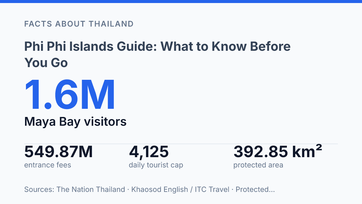
The Phi Phi Islands pulled more than 1.6 million visitors to Maya Bay in less than 10 months. The beach now runs on timed entry, daily caps, and closures that can rewrite your plan before you board a boat.
That tension is the real story here. This is a six-island group 42 km from Amphoe Mueang Krabi, set inside a protected area of 392.85 km², not just a single postcard beach with long-tail boats in the frame. In my honest opinion, Treating it like a quick beach hop is the mistake that turns a dream trip into a rushed queue.
This guide cuts through the basics that matter: where the islands sit, why they draw so much attention, how the boat journey works, and what arrival feels like when tourism is tightly managed. When Maya Bay reopened on October 1, 2024, access was capped by the hour. That detail changes everything.
Where the islands sit in Krabi Province
The Phi Phi Islands look like a Phuket add-on on many maps. They officially answer to Krabi.
The group sits in the Strait of Malacca, between Phuket to the west and the Krabi coast to the east. Administratively, it belongs to Krabi Province, not Phuket.
That distinction can feel fussy at first. It isn’t. Phuket dominates a lot of trip maps and boat-route language, so people assume the islands fall under Phuket by default. In my view, the Krabi link matters because it gives you the correct frame before the tourism shorthand takes over.
Geographically, the island group belongs to Thailand’s Andaman Sea side. Koh Phi Phi Don and Koh Phi Phi Leh are the two names most people recognize first.
They don’t make up the whole group. In 2026, the Tourism Authority of Thailand described Ko Phi Phi as a six-island group 42 km from Amphoe Mueang Krabi: Ko Phi Phi Don, Ko Phi Phi Le, Ko Yung, Ko Mai Phai, Ko Pida Nok, and Ko Pida Nai.
This location also explains why the islands can seem pulled in two directions. On paper, they are Krabi islands. In the way travelers talk about southern Thailand, they often sit between Phuket branding and Krabi geography… and that mismatch is where a lot of confusion starts.
What makes the island group so well known
Maya Bay became so famous that Thai authorities now manage it by the hour, not just by the season. Set on Koh Phi Phi Leh, the bay turned into a global shorthand for tropical escape after the 2000 film The Beach put its cliffs, pale sand, and enclosed turquoise water in front of millions of viewers.
That movie link explains something scenery alone doesn’t. Plenty of Thai islands have clear water and limestone walls, but few had one image reproduced so relentlessly in travel ads, bucket lists, and social media feeds. According to The Nation Thailand, Maya Bay received more than 1.6 million visitors between October 1, 2023 and July 22, 2024.
That number isn’t just popularity. It’s pressure.
The fame sits in sharp contrast with how small and limited the inhabited side really is. Koh Phi Phi Don is the only inhabited island in the group. It carries the practical weight: hotels, restaurants, tour offices, boats, nightlife.
The everyday services visitors need. Koh Phi Phi Leh may own the most famous image, but Koh Phi Phi Don handles the human traffic behind it.
The other force that fixed the islands in public memory was the Indian Ocean tsunami of 2004. It devastated coastal communities across the region and hit this island group hard, turning a place known for escape into a site of loss, recovery, and global news coverage. In my honest opinion, that’s why the islands’ reputation feels heavier than a normal beach destination.
The postcard view draws people in. The film connection and tsunami history explain why the name carries so much weight.
How to get there and what travel actually looks like
The last leg is always by boat. That one fact shapes the trip more than your choice of airport. Most visitors step ashore at Tonsai Pier on Koh Phi Phi Don, not at a quiet beach or private jetty.
It’s the main public arrival point, so expect luggage carts, boat staff calling out transfers. A quick shift from sea spray to foot traffic.
From Phuket, the standard route runs from Rassada Pier by ferry or speedboat. Ferries take longer. They cost less and give you more room to move.
Speedboats cut the ride time. They also turn a choppy crossing into a harder, louder trip. In my humble opinion, the fastest boat is a poor choice if you get seasick or hate being packed shoulder to shoulder.
Krabi Town works differently. Boats usually depart from Klong Jilad Pier, with ferries and faster services linking the mainland to Koh Phi Phi Don. Ferryhopper lists the sea distance from Krabi at about 25 nautical miles, with trips taking anywhere from 45 minutes to 3 hours depending on the vessel and exact port.
That range matters. A “short transfer” on paper can eat half a day once check-in, boarding, and pier transfers are included.
Ao Nang is the more convenient base if you’re already staying along the beach strip. Departures commonly run from the Ao Nang area and nearby piers, including services that connect through Railay in some schedules.
It can feel simpler than backtracking into Krabi Town. The tradeoff is fewer sailings at certain times and more dependence on sea conditions.
Crowds aren’t a small detail here. Thailand’s Marine Department recorded 5,297,512 sea-area passengers in Krabi in 2024, according to its statistical reporting.
That volume explains the early check-ins, fixed departure windows, and occasional pier crush. Book the route that fits your tolerance, not just the one with the shortest advertised ride.
What to expect once you arrive
The shock isn’t the scenery. It’s how quickly the narrow lanes can feel full after the morning boats empty out. Koh Phi Phi Don has the main hotels, shops, restaurants, beach bars, dive offices, tour desks, and nightlife. If you’re staying near the central village, expect convenience first and calm second.
Rooms range from simple guesthouses to polished beachfront resorts, but location matters more than star rating here. A cheaper room near the party areas can mean late music, foot traffic, and very little sleep. A quieter stay usually means walking farther, climbing steps, or paying more for a place set away from the busiest strip.
You won’t move around the island group like you would in a city. Longtail boats are the normal way to reach nearby coves, snorkelling spots, and beaches that don’t sit beside the main walking routes. They give you freedom, but they’re still weather-dependent, price-sensitive, and louder than the postcard version suggests.
Peak season runs from November to April. That changes the whole feel of a visit. People arrive expecting a remote island break.
The busiest parts feel packed fast… and that gap between image and reality is the real story. In my view, Beauty doesn’t erase pressure. It makes the pressure more visible.
The strain isn’t abstract. Heavy tourism means more boat traffic, more rubbish to manage, more demand for water, and more stress on reefs and beaches. The surrounding Hat Noppharat Thara–Mu Ko Phi Phi protected area covers 392.85 km² as of July 2026, according to UNEP-WCMC / Protected Planet, but protection doesn’t mean untouched.
Plan with that contrast in mind. Book accommodation early in the dry months, carry cash for boat trips and small purchases, and leave space in your schedule for delays.
The islands can still be spectacular. They just aren’t effortless.
Why timing matters more than the postcard
The smartest move now is to plan around limits, not against them. Check park notices before you book, especially after closures like August 1 to September 30, 2024, when Maya Bay, Loh Samah Bay and Lo Ko Bay shut for recovery and monsoon safety.
Boats make the trip feel simple. The system behind them is huge. Krabi recorded 5,297,512 sea-area passengers in 2024, and places such as Ko Phi Phi Tourist Pier sit at the center of that pressure. In my humble opinion, the best visit isn’t the one that packs in the most stops.
It’s the one that leaves room for tides, rules, crowds. The fact that paradise now has a schedule.
Frequently Asked Questions
Q: How do you get to the Phi Phi Islands from Phuket or Krabi?
A: Most travelers go by ferry or speedboat from Phuket or Krabi. The trip is short. The sea can be rough on some days, so timing matters. If you get motion sick, pick the smoother option and leave extra time.
Q: Where exactly are the Phi Phi Islands located?
A: They sit in Thailand’s Strait of Malacca, between Phuket and the Krabi coast. The islands are administratively part of Krabi Province. That location is a big part of their appeal. It also means access depends on boat schedules.
Q: What is the best time to visit the Phi Phi Islands?
A: The dry season is the safest bet for calmer water and easier boat trips. Wet months can still work, but weather changes fast and plans can shift. In my view, if you want the least stress, build your trip around stable sea conditions, not just cheap fares.
Q: Do you need to stay overnight on the Phi Phi Islands?
A: No, a day trip works for some visitors. But staying overnight gives you more time when the boats leave and the crowds thin out. If you hate rushing, one night makes the trip feel far better.
Q: Are the Phi Phi Islands expensive to visit?
A: They can be, especially once you add boat transfers, accommodation, and tours. A basic visit is still possible on a tighter budget. The extras add up fast. The smartest move is to book early and compare transport before you commit.